


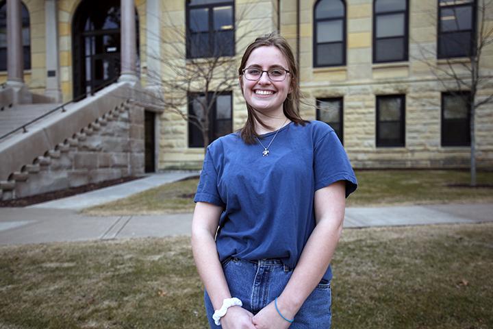


GIS discussions with Hannah Weber
May 17, 2023
Staff member Carly Davis spoke with senior geography major Hannah Weber about grass types, GIS programs and groundskeeper services.
CD: Did you come to Augie to do GIS?
HW: I didn’t have any idea what GIS was before I came to Augie. I had never heard of it. And then, it wasn’t even a minor. I came here to study geology and environmental studies. Then I took one geography class and realized that I really loved the human element of things, and in geology, there wasn’t enough of that. And I really love the geography department.
CD: So, how did you get into GIS?
HW: You’re required to take it for the geography major. All you’re required to take is an introduction to GIS class. I thought I was going to hate doing a computer program, but it was actually so much more fun than I thought it was going to be. When [Dr. Heine] told us he was making it a minor, I really wanted to jump on that opportunity because it’s a really employable skill and asset to have.
CD: Is geospatial data like a landscape or topographical map?
HW: It can definitely do the more physical element of things. You can
have your topography or elevation, but you can also map different kinds
of data–they call it raster and vector data—and you map the human element of things. Population dynamics, or if there’s a blue state or a red state, so it’s not just physical elements.
CD: Are you capturing our campus?
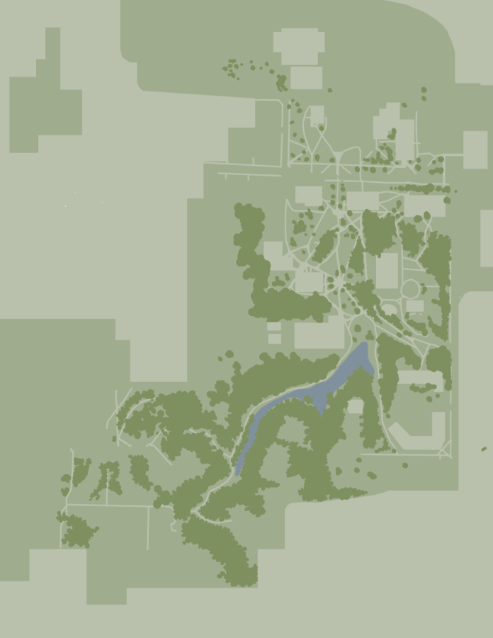
HW: I’m mapping the turf areas on campus. This is a small independent project that we have to do for class. We’re mapping the turf on campus, and I don’t mean synthetic turf, just grass, basically. I worked closely with Josh Becker this past summer doing the Augie Acres internship, and he’s the ground services manager. When Dr. Heine was telling us we had to do a project with GIS, I knew Josh was
familiar with GIS and interested in the ways we could apply it to Augie and to ground services to help them out.
And then Josh told me that it would be helpful to map the turf on campus because he’s trying to look for new contractors for spraying chemicals, so it helps to get a better idea of the square footage on campus. If he knows the square footage of turf he’ll have to spray…he can know how many gallons of fertilizer or chemicals, whatever he has to use, and tell contractors to get estimates.
Josh…knows campus like the back of his hand. We have an aerial image that was taken with drone footage that Dr. Heine and the GIS class did last year. We’re zooming in on these parts to select which areas are grass and make our little shapes on that grass area, and then Josh can select it. We ultimately had to go in by hand and trace the shapes, drawing them, outlining them.
CD: Augie is a very tree-covered campus, has that been an impediment?
HW: It’s an impediment. For sure. We had to have Josh come in and show us some trouble areas and he already knew off the top of his head — what tree coverage is there, and specific areas that he knew. Some trees have mulch at the bottom by their trunk, so we don’t need to trace that, but then other trees don’t, so we can just cover them in the polygon. Sometimes you have to work around them, sometimes you don’t. It’s kind of a case-by-case thing.
CD: So, you’re just doing the math?
HW: Literally just here to do the STEM girl stuff. But there’s plenty of ways [Becker] could probably apply it. It’s also just knowing how many square feet of turf there is on campus, which I think could be useful no matter what. He can also select certain polygons or all of them, whatever he wants to do, and then write what he’s sprayed or when he doesn’t. He can use that to have this repository of information. Maybe he’ll try other chemicals, he can keep that information in there.
CD: What was your Augie Acres project over the summer?
HW: They have one intern over the summer to run the garden… Then also having to figure out what to plant. They just got raised beds in the garden this summer, so what’s the best thing to plant there? What will look good for the future? Mostly this year it’s just focused on fixing up the garden, cleaning it up because there was a huge area that had been untouched by could be utilized. It was a lot of physical labor.
CD: Do you feel like your GIS work has equipped you for the future? Do you know what you want to do after college because of it?
HW: It’s probably one of the most useful skills I’ll leave Augie with. It’s super employable, it’s in high demand, and as our worlds become more connected, there’s a bigger need for it. I don’t know what I want to do with my life — that is not GIS’s fault, that’s mine— but it’s opened up a lot of doors and opportunities because a lot of jobs now will require or prefer that you have some experience with GIS. It goes beyond the field of geography, like environmental, geology, even health. You know, it can come in handy for sociology. It’s just a really interdisciplinary and useful tool to have. It’s nice knowing that I have GIS where a lot of
options are open.